Fort Cascades in Skamania County
Nestled just a stone’s throw beneath the Bonneville Dam on the Columbia River between Oregon and Washington lies an unassuming National Historic Site filled with stories worth telling. On a recent work trip to the south end of Skamania County, I stumbled upon this great heritage destination.
If you’re looking to escape a bustling city without traveling too far into the void of central Washington, Skamania County is an excellent choice. I happened to be attending the annual Washington State elections conference held at Skamania Lodge in Stevenson and didn’t have a chance to explore the region until the return trip home. Fortunately, the lodge, dam, historic site – and something called the “Bridge of the Gods” – are all within a few miles of each other.
The Bridge of the Gods refers to two different things depending on who you’re asking. Travelers know it as the steel span connecting Washington’s State Route 14 with Oregon’s Interstate 84. An interesting side note about the bridge is that it was much lower when it was built in 1926. But the US Army Corps of Engineers had to raise it up some 40 feet when the dam was built in 1938, creating a backwater that would have submerged the old bridge.
Geologists know Bridge of the Gods to be something else entirely. About a thousand years ago, the sides of the Columbia collapsed into the river creating a natural dam. The river backed up for miles, creating an inland sea all the way into Idaho. Eventually, the river broke through the dam and returned to its previous course.
Native Americans tell a different story about this geological event. Long ago, the Great Spirit built a bridge to allow his people to cross the river. But his three sons, in a battle over a woman, destroyed the bridge by hurling stones upon it. Those three sons were Mount Adams, Mount Rainier and Mount Hood and the “stone hurling” was no doubt ancient volcanic activity.
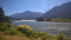 Just west of the bridge is the Bonneville Lock and Dam, an impressive pair of structures created as part of President Roosevelt’s New Deal. They were declared a National Historic Landmark in 1987. Not wanting to miss out on picture opportunities, I stopped at the overlook near the dam and found another sign pointing the way to Fort Cascades, just a few hundred yards further down.
Finding an empty parking lot and a kiosk full of interpretive pamphlets, I set off to discover something new about Washington history!
The site had one of my favorite features: an interpretive trail that allows you to stop at numbered guide posts and read a portion of the pamphlet to learn about what occurred on or near the area where you’re standing. This was just a 1.5-mile loop but it took me through the former site of Fort Cascades, the small town of Cascades, a fishwheel, a railroad terminal, two portage roads and a grave site. What more could I want?
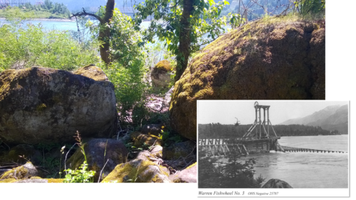
First stop is the Warren fishwheel, a technology made popular in the 1880s and outlawed in Washington by 1934 on account of how successful they were at pulling large quantities of salmon out of the river. Named for the Warren Packing Company that operated the device, the fishwheel is long gone but you can still see the spot where it jutted out into the river.
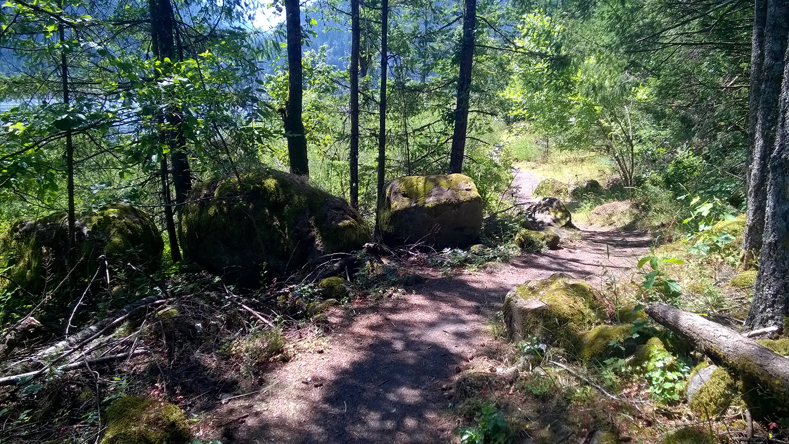
Additionally, rivers tend to swell and shrink in size over time and the Columbia is certainly no different. In 1894, the highest waters ever recorded on the river devastated the small town and scoured away much of the soil. What was left when the waters receded were dozens of huge boulders – once buried – now exposed for the remainder of time.
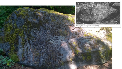
A little further down the trail is a site not uncommon in Washington. One of the huge boulders has been carved with an ancient design by the people who first inhabited the area. The petroglyph on the trail is actually a replica of the original, which is now located in front of the Skamania County courthouse annex in nearby Stevenson.
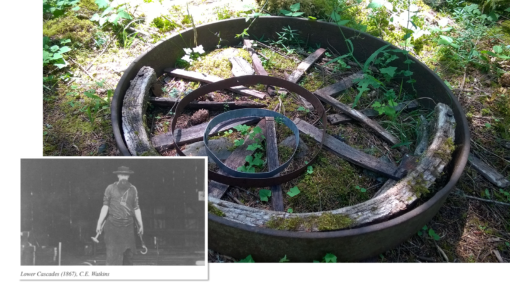
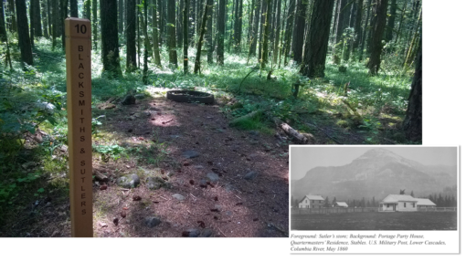
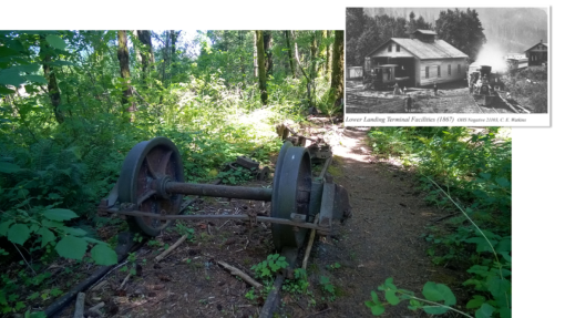
On the flip side of the trail once it loops around, you’ll find a post indicating the site of the blacksmith’s shop and Sutler’s store. On the site of the blacksmith’s shop, you’ll also find the first actual remnants of the former townsite lying on the forest floor…what appears to be a wagon wheel long abandoned.
Sutler’s store was essentially a general store where townsfolk and soldiers could purchase items of convenience as well as staples of everyday life in the late 1800s. It was the only non-military store allowed within the fort and it sold items such as tobacco, candy and coffee to soldiers.
One of the final stops along the trail is also the most impressive to history buffs like myself. It’s the site of the Cascade Portage Railroad, which operated from 1863 until shortly after the flood of 1894. It was a narrow gauge railroad and some of the track, couplings and wheel assemblies are still found on site. For more pictures of the antique railroad equipment, please check out my pictures on Flickr.
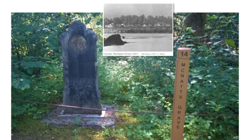
The last post before the trail ends is the headstone of one Thomas McNatt. Once buried on that exact spot, his remains have since been moved to a family plot owned by his descendants. McNatt was a key member of the Cascades community in the mid 1800s, operating a hotel, barn and stables until his death from a lengthy illness in 1861.
The short hike through history was a fun, fascinating adventure fit for any family looking to explore Washington’s beautiful Columbia Gorge. I discovered it on my own, but I’m definitely coming back with the kids. My only suggestion for improvement would be to take a page from the Fort Spokane playbook and clear cut just the areas where the foundations of buildings once stood. It would really enhance an already enjoyable experience and bring history to life that much more for visitors new to heritage sites.

