Ft. Eaton, and the Indian War of 1856
We’re leaving for Carmel, California, tomorow to spend Christmas with my inlaws. My job today, besides packing and cleaning house, was to drop the dog off at the boarding facility. Living in Lacey, we board her at Northwind Kennels, which is just a short drive southeast on the Yelm Highway from our house. On the way, I drove past a small, brown sign that read, “Historical Marker” with an arrow pointing left. I made a mental note…check out the historical marker on the way back.
 After a quick goodbye to our seven-year-old Blue Heeler mix, Kala, I began the short return trip to the house. Very soon after, I saw it again. “Historical Marker,” this time with the arrow pointing right. It snuck right up on me because the speed limit on that stretch of Yelm Highway is 50 miles per hour and there was no room to even second guess your destination. Fortunately, there wasn’t anyone behind me and I was able to quickly pull off the road to check it out.
It’s funny, but in the five and a half years we’ve lived here, I must have driven that stretch of Yelm Highway two or three dozen times. I can’t remember ever noticing the sign before, and this was the first opportunity I’d had to really take a look at it.
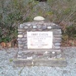
 The pullout is nothing more than a 50-foot wide spot in the road, and as I said if you’re going by at 50 mph it’ll pass by in the blink of an eye. The first thing I noticed upon pulling over was that it was surrounded on three sides by private property. It wasn’t the suburbs mind you, but it was definitely in active, everyday use. I made my way up the short stairway to the aforementioned historical marker, a stone and concrete structure about three feet high that resembled a headstone. I’ve seen countless “historical markers” in my short 36 years, and most of them commemorate a battle or other significant event. This one, however, was the former site of Fort Eaton – a small civilian outpost created to help ward off Indian attacks during the war of 1856.
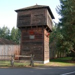
 Now sometimes when you visit the site of a historical fort, you’re treated to a replication of the actual bastion itself. Take Fort Nisqually at Point Defiance in Ruston for example. It’s a real living replica of the original Fort Nisqually that was originally located near what is now DuPont, Washington. This historical marker that I was now staring at was nothing like the Point Defiance site. What I was standing before was a concrete headstone with a short message, and a very old, yet-to-be-identified tree.
“Fort Eaton. Built by settlers during the Indian War of 1856. Erected by Freedom Community 1932.”
I thought to myself that I’d have to do more research when I got home to find out about this Indian War of 1856. After all, it’s an integral part of Washington State history that I know nothing about. As it turns out, there’s quite a bit of interesting history here. From Wikipedia:
“The catalyst of the war was the Treaty of Medicine Creek of 1854.Negotiated by Washington Territory Governor Isaac Stevens, the treaty preserved Indian fishing rights, but took away prime Nisqually farm land. Leschi, chosen to negotiate the treaty with Stevens, was outraged and chose to fight rather than give up his land. The fighting commenced in October 1855, when “Eaton’s Rangers,” a citizen militia under Captain Charles Eaton, were involved in a clash with Nisqually tribesmen. Two militiamen, Joseph Miller and Abram Benton Moses, were killed. Upon hearing the news, Governor Stevens immediately dispatched a company to locate Leschi and “escort” him back to Olympia.
The war itself consisted of a series of short skirmishes with relatively few deaths on either side. Notable battles occurred in present-day Tacoma, Seattle, and even as far east as Walla Walla. In particular, on October 28, 1855, a party of Muckleshoot killed eight settlers in what was later called the White River Massacre. Three children fled on foot to Seattle, but one five-year old boy was kidnapped and held by the Muckleshoot for six months before being released.
Leschi was captured in November 1856 and was forced to stand trial for the murder of Abram Benton Moses. His first trial resulted in a hung jury because of the question of the legitimacy of murder during wartime; the jury of twelve voted ten in favor, two opposed to conviction. Leschi was tried again in 1857. Despite vague witness accounts and issues over whether Leschi was actually at the scene of the incident, he was found guilty of murder. Leschi was hanged on February 19, 1858.”
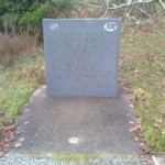
 Approximately forty feet to the left of the historical marker was another marker of an entirely differenty type. This one, I read thoroughly several times and still didn’t comprehent what it meant. It was quite wordy, so I had to record its prose in my cellphone so I could transcribe it later in this blog. It read:
“Willamette Meridian: You are standing on the Willamette Meridian, which is the principal survey line from which the rectangular surveys of Washington State were commenced. William Ives, deputy surveyor, commenced this survey of the Willamette Meridian from the initial point near Portland, Oregon, on June 4th, 1851. Passing this point on August 14th, 1851, he and his crew of five men surveyed the 110 miles from Portland to a point on Puget Sound 8 miles north of this point in 74 days, marking trees every half mile, many of these markings may be found to this day. Dedicated by the Land Surveyors Associaton of Washington on November 11, 1989, in commemoration of the Washington Centennial.”
My guess is that it was sheer coincidence that Fort Eaton was built right on the Willamette Meridian, but nevertheless the two markers are withing mere feet of each other. I have to admit, it’s fascinating to think that I play golf just a few thousand feet from a location that bears such historical significance. It forces me to stop and think every now and again, that the trivial problems I deal with every day…like waiting in traffic while construction crews continue to widen Yelm Highway, or wondering if the new structure next to the QFC is going to be a strip mall or something more useful…are nothing compared to the impending threat of Indian attacks or scientific exploration in its purest form.
There really is a lot more to learn about these issues, and I can’t quite relay it all to you in the space of this blog entry. Click the links above to get the whole story about these things. In the meantime, I’ve got to get to bed. As I said earlier, we’re flying to California in the morning and I’ve got to get up early.

I would like to correct my prior comment. Leschi’s direct descendant, Larry Seaberg, informed me that Ancestry.com is incorrect in claiming that one of Leschi’s three wives was Sara Hazel Martin. She is an ancestor of Billy Frank, Jr., and belongs to a different family tree altogether. Larry informed me that Kala Kala was instead born to Leschi and his first wife, Silolassara.
In response to a comment below by Cd Avendano: thank you for that fascinating comment. Ancestry.com indicates that Charles Eaton’s wife, Kala Kala Jennie Jenny Jane Leschi, was the daughter of Chief Leschi and his German wife, Sara Hazel Martin, and that Chief Leschi’s three wives bore him six daughters and one son. See https://www.ancestry.com/genealogy/records/chief-leschi-24-224vc8z.
What many people don’t know is that immediately before the war, Chief Leschi traveled to Olympia to try again peacefully to convince the acting governor to reconsider and give the Nisqually better land, including land that Chief Leschi and his brother, Chief Quiemuth, had been farming at that time. His meeting did not produce results at that point and so he returned to his farm and to Quiemuth to finish the fall plowing. Soon thereafter, the acting governor sent a volunteer militia (headed by Captain Eaton) to arrest Leschi and his brother because skirmishes between the Yakama and some marauding miners had broken out after the miners raped and possibly murdered one or more Yakama women. Although the skirmishes involved members of the Yakama tribe, not the Nisqually, the acting governor wanted Leschi and Quiemuth arrested to disable Nisqually leadership in advance. But the act of sending soldiers to arrest leaders of a sovereign nation constituted a declaration of war. See “An Unusual Judicial Look at a Historical Injustice,” Chung, Erica S.; Morton, Monto S.; Smith, Charles Z., ed (2004), Washington State Minority and Justice Commission, Biennial Report 2003 – 2004, Olympia: Washington State Supreme Court, p.35. Viewed at https://www.courts.wa.gov/committee/pdf/MJCBiennial2003-04.pdf on 11/8/2022. See also “Nisqually Chief Quiemuth is murdered in Olympia on November 19, 1856,” Caldbick, John (1/18/2012), HistoryLink.org, Essay 10007. Viewed at https://www.historylink.org/File/10007 on 11/13/2022.
In any case, Leschi’s efforts bore fruit ultimately: As the fighting wound down, Governor Stevens reconvened treaty negotiations and gave the Nisquallies more land. This included critical access to the Nisqually River. It also included Muck Creek, where Leschi and his brother, Chief Quiemuth, had farmed before the war. Id. (HistoryLink.org, Essay 10007).
My grandfather was the president and starter of the Freedom Grange in the Evergreen Valley and was at the dedication of the marker along with my 10 year old mother. I have pictures of the dedication but don’t know how to post them to this side. You could contact me @ 541-786-2245 in a TEXT.
Amazing story! Thanks for sharing your firsthand knowledge and for telling us about Gleanings for the Hungry. It sounds like a wonderful, altruistic organization. If you want to explore more about the Indian Wars, check out my podcast on the Medicine Creek Treaty at http://washingtonourhome.com/medicine-creek-in-search-of-treaty-tree/.
That’s the “old hanging tree” as my grandfather called it (& he used to mow around it). I used to live in the house near there on Eaton Creek Lane that my grandfather built. There was a lot of awful things in history especially local history towards first nations & Black folx… My grandparents sold their house to friends who turned his old boat house into a huge fish dehydration plant (they get fish from local tribal members apparently) & send the fish around the world to feed the hungry (thru Gleanings for the Hungry), which is pretty incredible given the history. I grew up playing at that creek a lot & had no idea it was formerly Medicine Creek & was believed to have healing powers. I like to think the work being done now with the tribe’s descendants helping with this fish dehydration/gifting that is sent around the world is healing.
Wow, what a story! I’d love to hear more about your family’s history in Washington State for another future blog entry (or more). Are you located in the south Puget Sound area? Send me an e-mail at admin@washingtonourhome.com and let me know. I’d love to meet you and see some old family photos if you have any!
Thank you for writing this blog. I am Charles Eaton’s great, great, great grandaughter. He was the captain in charge of bringing Chief Leschi in to be tried. What most people don’t know is that Charles Eaton married Chief Leschi’s only daughter, therefore, I am direct decendent of Charles Eaton and Chief Leschi. Thanks again.
Cool! Thanks for reading my post. I must try hiking the trail and blog about that someday. One thing my wife and I couldn’t figure out was, what the heck is the purpose of a meridian? What I mean is, back in the 1800’s, what would prompt a person to say to themselves, “You know what we need? We need a straight line from Portland, north. What do you say, guys? You with me?”
I helped put up the Willamette Meridian marker in 1989. A related site is the William Ives trail in Meridian Campus in Lacey. The north south Meridian Road is on the Willamette Meridian.